Shell Island Tides: When to Snorkel, Beachcomb, and Watch Dolphins
- PCB Prestige

- 13 minutes ago
- 10 min read
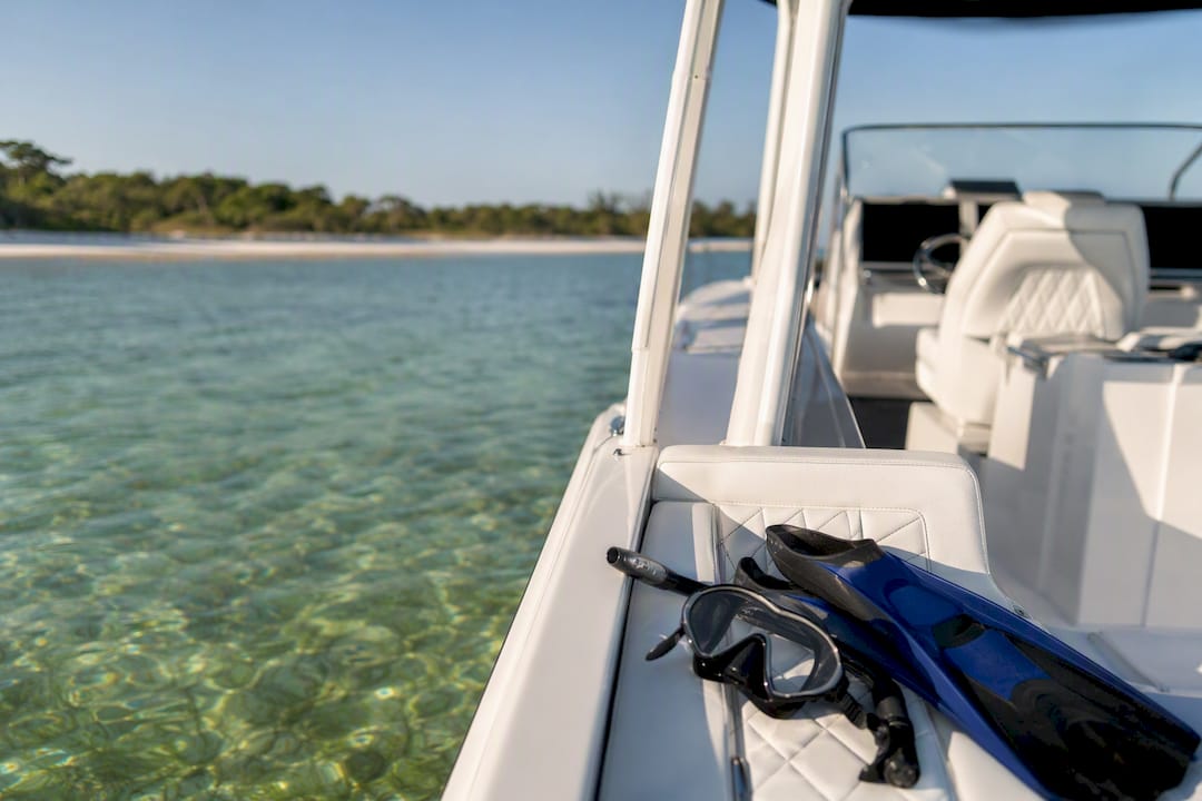
Check today’s tide chart for Shell Island before you pack the cooler. For snorkeling, aim for the hour around high tide or slack water. For shelling, low tide is your window, but watch the clock so the incoming water doesn’t strand you on a sandbar. For dolphin watching, an incoming tide or calm morning high tends to produce the best sightings.
The fastest way to plan: pull up NOAA’s tide station 8727359, note today’s high and low times and heights, then build your schedule around them.
Snorkeling: near high tide or slack water
Shelling/beachcombing: low tide, with a firm exit time set before the tide turns
Dolphin watching: incoming tide or the morning high, when water is calmer
Key Takeaways
Timing your Shell Island trip around the tide, not the clock, is what separates a smooth day from a stressful one.
Point | Details |
Check date-specific data | Pull today’s exact tide times and heights from NOAA station 8727359 before you leave. |
Match activity to tide stage | Snorkel near high or slack water, shell at low tide, watch for dolphins on an incoming tide. |
Respect the tidal range | A 1.6 to 3.4 foot swing can flood a dry sandbar or expose a hidden channel within an hour. |
Cross-check wind and surf | A calm tide chart means nothing if wind or storms are churning the water that day. |
Consider a guided option | A private, tide-aware charter removes the timing guesswork for families and first-time visitors. |
Table of Contents
How Shell Island Tides Work Day to Day
Most days at Shell Island bring two high tides and two low tides, roughly six hours apart. That pattern, called a semidiurnal cycle, is why the “best” time to visit shifts by about 50 minutes each day. A tide chart that worked perfectly for last Tuesday’s snorkel trip will be off by nearly an hour a week later.
Between each high and low sits a short period called slack water, when the current all but stops before reversing direction. This is often the calmest stretch of the day and the reason snorkeling guides consistently point toward high slack as the safest visibility window.
Not every tide cycle behaves the same. Spring tides, which happen around the new and full moon, produce bigger swings between high and low and stronger currents. Neap tides, which fall in between, are gentler and more forgiving for less experienced swimmers.
Two highs and two lows roughly every 24 hours, shifting time daily
Slack water: the calm pause between tide changes
Spring tides: bigger range, stronger current, more caution needed
Neap tides: smaller range, easier conditions for beginners
Pro Tip: Look up the moon phase along with the tide chart. A full moon within a day or two of your trip usually means a spring tide, so plan extra buffer time before the water turns.
What Tides at Shell Island’s North End Actually Look Like
Shell Island’s north end, near Crystal Bay, typically sees high tides in the 1.6 to 3.4 foot range, with lows dropping to around minus 0.4 to 1.3 feet depending on the date and the moon phase. That’s not a fixed number. Every tide table is date-specific, and the exact heights change week to week, so treat any figure here as a ballpark, not gospel for your trip day.
A two to three foot swing sounds small until you’re standing on the shallow flats that ring the island. Sandbars that are dry and walkable at low tide can be under two feet of water within a few hours. Channels that look shallow enough to wade across at low tide can develop real current once the water starts moving back in.
Local tide calendars from sites like US Harbors and TideTime lay out day-by-day highs and lows in Eastern Daylight Time, which makes it easy to sanity-check one source against another before you leave the house.
Typical high tide: roughly 1.6 to 3.4 feet
Typical low tide: roughly minus 0.4 to 1.3 feet
Spring tides push both numbers higher and lower than average
Ranges and times are date-specific. Always check the day you’re actually going
Spring tides around the full and new moon widen that range further, which means faster-moving water in the cuts between sandbars. If you’re visiting during one, add extra margin to any exit plan.
Best Tide Windows for Snorkeling, Shelling, and Dolphin Watching
Timing each activity around the tide isn’t a nice-to-have here. It’s the difference between clear water and a murky mess, or between an easy walk back and a scramble against incoming current.
Snorkeling: Plan your swim for the hour before or after high tide. Deeper water covers the grass flats and rocky patches, current slows to near nothing at slack, and visibility tends to hold up better than during a fast-moving low.
Shelling and beachcombing: Low tide is when the widest stretch of sand and shell beds shows itself. The catch is timing your walk back. Give yourself a hard stop at least 90 minutes before the tide turns so you’re not wading through a channel that’s filling in behind you.
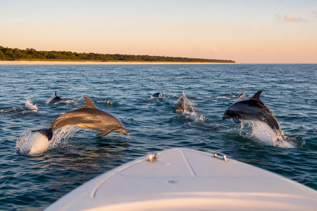
Dolphin watching: An incoming tide, especially paired with a calm morning, tends to concentrate baitfish into predictable feeding zones, which is exactly what draws dolphins close to shore. Early risers usually see more activity than midday visitors, partly because boat traffic and wind both tend to pick up later.
Wind and surf matter as much as the tide number itself. A perfect high-tide slack window means nothing if a 15 knot onshore wind has churned the water into chop. Always check the marine forecast alongside the tide chart, not instead of it.
Pro Tip: If dolphin watching is your main goal, check the tide chart for an incoming tide that lines up with early morning. That combination shows up again and again in local reports as the strongest window for sightings.
Tide-Related Safety Rules Every Visitor Should Follow
Shell Island’s biggest hazard isn’t the open Gulf. It’s the inlet and channel currents that speed up as the tide changes, plus the simple math of a sandbar that was dry when you arrived and is gone by the time you want to leave.
A rising tide can cut off a sandbar walk faster than most visitors expect, sometimes in under an hour depending on how fast the water is moving that day. Getting stranded on a shrinking sandbar, or caught in a channel current while wading back to the mainland side, accounts for a good share of the close calls reported around barrier islands like this one.
Before you head out, run through this list:
Check the tide chart for today’s exact high and low times and heights, not yesterday’s
Set a firm turnaround or exit time, built around the tide, not your mood
Wear a life jacket for kids and weak swimmers, especially near any channel
Skip solo snorkeling during a strong incoming or outgoing tide
Check wind and surf forecasts alongside the tide chart before committing
Call off water activities entirely if winds are pushing past small craft advisory thresholds, if you’re not confident reading the day’s tide schedule, or if you can’t identify a safe exit point before the tide turns. None of that is overly cautious. It’s just how barrier island currents work.
How to Check Tide Times for Shell Island Before You Go
Start with NOAA Tides & Currents station 8727359. It’s the federal government’s own predicted tide data for this stretch of coast, and it’s the source every other tide app pulls from or compares against.
From there, cross-check against a second source like tide-forecast.com or Tides4Fishing, which often display the numbers in an easier day-by-day calendar format.
Pick your visit date and pull up that day’s chart, not a general average
Note every high and low time, plus the height in feet
Confirm the times are listed in Eastern Daylight Time
Pick your activity window relative to the nearest high or low
Check wind and surf conditions for the same day
Build in a 30 to 60 minute buffer before any tide change
Primary source: NOAA station 8727359
Backup sources: tide-forecast.com, US Harbors, Tides4Fishing
Always confirm the time zone before locking in a schedule
Why a Private, Tide-Aware Tour Skips the Guesswork
Reading tide charts is a skill. Reading them correctly, then matching that data to wind, current, and boat traffic in real time, is a different job entirely, and it’s the one Pcbprestige does on every trip out to Shell Island.
Pcbprestige runs private dolphin and snorkeling charters on a 26-foot powerboat, captained by a licensed local skipper who already knows how that day’s tide is shaping current and visibility around the island. Trips are built around ethical wildlife viewing, meaning the boat approaches dolphins at a respectful distance instead of chasing pods for a photo.
Fully private charters for up to 6 guests, no strangers on board
Captain factors in tide and weather before setting the day’s route
All snorkel gear included, so you’re not scrambling to rent equipment last minute
Flexible scheduling around the tide windows that actually matter for your group
That local tide knowledge is also what makes the trip work for families with young kids or nervous swimmers. Instead of trying to interpret a NOAA chart yourself, you show up and the timing is already handled.
If you’d rather book the water time than manage the tide math, reserve a private tour or browse the full lineup of Shell Island tours to find the length and format that fits your group.
How Wind and Storms Change the Tide Picture at Shell Island
Tide height only tells half the story. Wind direction and speed can push water levels higher or lower than the predicted chart, sometimes by a foot or more during a strong onshore blow. A sustained south wind ahead of a front can stack extra water against the island even at a normal low tide, while an offshore wind can pull water out faster than the chart predicts.
Storms compound the problem in two ways. First, rough surf churns sediment into the water column, killing visibility even during a textbook high-tide slack window. Second, storm surge and heavy rain runoff change current patterns around the inlets, sometimes for a day or two after the weather clears.
Summer afternoon thunderstorms are the most common wrinkle for Panama City Beach visitors. They tend to build through the early afternoon, which is one more reason morning tide windows are worth prioritizing for both snorkeling and dolphin watching. A clear tide chart and a 20 knot wind warning are two different pieces of information, and you need both before deciding whether to get in the water.
Gear to Pack Based on the Tide You’re Working With
What you bring should change depending on whether you’re timing a high-tide swim or a low-tide shelling walk. A mask, snorkel, and fins are non-negotiable for the water, along with reef-safe sunscreen since you’ll likely be in the sun and the water for hours. Water shoes matter more than most visitors expect, especially at low tide when sharp shell fragments and oyster clusters are exposed on the flats.
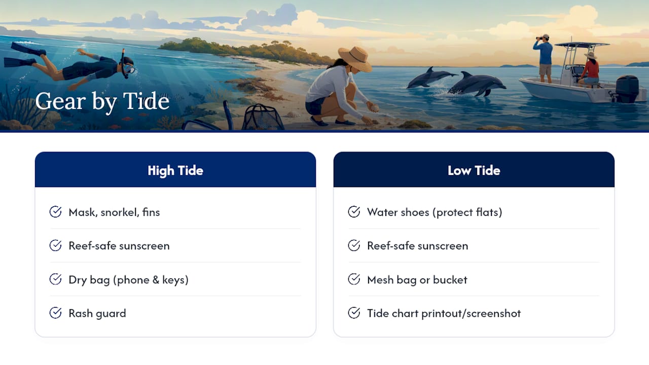
For a high-tide snorkel session, pack a dry bag for your phone and keys, since you’ll be swimming rather than walking. A rash guard helps with both sun exposure and the occasional brush against grass beds. For low-tide shelling, bring a mesh bag or bucket for finds, and consider a small tide chart printout or a saved screenshot in case cell service drops near the island.
Bring more water than you think you’ll need. Shell Island has limited amenities, and a few hours of sun exposure between tide windows adds up fast, particularly for kids.
Rules and Restrictions Tied to Tide-Dependent Activities
Shell Island sits within Shell Island Preserve State Park land managed under Florida’s park system, and general Florida shell collecting rules apply: hand collecting empty shells is generally allowed, but taking live shellfish, sand dollars, or any live marine organism typically falls under separate Florida Fish and Wildlife regulations with its own limits and seasons. Check current Florida Fish and Wildlife guidance before collecting anything that might still be alive.
Dolphin viewing carries its own set of expectations under federal marine mammal protections, which generally call for keeping a respectful distance and never chasing, feeding, or touching wild dolphins. That’s part of why an ethically operated charter matters. Approaching dolphins the wrong way isn’t just bad etiquette, it can carry real legal consequences.
There’s no boat ramp or bridge access to Shell Island itself. Visitors reach it by private boat, kayak, or charter, which means tide height directly affects how close a boat can safely approach shore and where it’s safe to anchor. Sandbar access on foot from shallow-draft boats depends heavily on the tide stage that day.
What the Tide Charts Don’t Tell You
Most Shell Island advice stops at “check the tide chart,” and that’s not wrong, it’s just incomplete. A chart tells you when the water will be high or low. It says nothing about wind direction, how fast a channel current is actually moving that day, or whether a sandbar that’s dry now will still be dry in 40 minutes.
The gap I’d flag for first-time visitors is overconfidence in a single data point. People pull up one tide table, see “high tide at 11am,” and treat that as the entire plan. Real conditions change that plan constantly: an unexpected south wind, an afternoon storm cell building on the radar, a current running stronger than the chart height would suggest.
My honest read is that the visitors who have the smoothest trips are the ones who treat the tide chart as a starting point, not a final answer, and who build in real buffer time around every activity. That’s also the strongest case for a guided option. A captain who reads this water daily catches the details a printed chart can’t show you, and that local judgment is worth more than any app on a day when conditions turn.
— Justin
Sources
Recommended
Comments